
How Drone Progress Updates Save PMs Hours Each Week
Imagine getting a bird’s-eye snapshot of your jobsite in minutes, detailed enough to measure progress or spot issues. Today’s forward-thinking general contractors (GCs) and project managers (PMs) are embracing just that. Instead of trudging around the site and writing pages of updates, they send up a drone to capture aerial photos, 3D maps, and flyover video. These visuals turn weeks of work into clear progress reports for the whole team.
Drones are powerful data machines. One flight can cover a sprawling site in minutes, generating orthomosaic maps, 3D terrain models and volumetric measurements. This replaces days of manual surveying. The images feed into software tools to give instant site metrics (like volume of materials placed) and annotated plans. In effect, one drone mission delivers the “big picture” percent-complete and the pinpoint details, all in one package. Here are several ways drone save project managers hours of paper works each week:
Streamlining Project Updates with Aerial Data
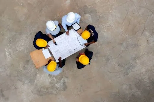
Weekly status meetings become much leaner when drones handle the heavy lifting. Instead of walking the entire site to photograph new work, a drone flight provides a comprehensive site snapshot in minutes. That imagery is automatically stitched into progress maps and photo logs. With tools like DroneDeploy’s Procore integration, the photos sync directly into your daily log and project album, building your visual record without extra admin.
Faster site surveys. A single drone flight covers hours of ground work in a fraction of the time. Many teams fly weekly or even daily to capture updates on the spot.
Automated reporting. Drones paired with cloud software generate shareable maps and reports instantly. Progress photos and metrics upload themselves into Procore, dramatically cutting the manual photo-collection tasks.
Visual QA and issue spotting. High-resolution overhead images highlight problems immediately. Misplaced materials or construction errors pop out when you overlay the as-built view on the plan. For instance, Stiles Construction can overlay its plans on drone maps to check work before concrete pours, preventing rework.
Aligned teams. Everyone sees the same up-to-date picture. With drone imagery linked to project records, field crews, office teams and owners all reference identical visual data. This cuts miscommunication and keeps the project aligned.
Answering RFIs Faster
Responding to RFIs (Requests for Information) is another major time-sink that drones can streamline. Instead of scrolling through photos and plans, a PM can point to exactly what’s been built. For example, PCL Construction found that without aerial data “RFIs took longer to resolve” because their records were unclear. Now they overlay plan drawings on drone images, click on the exact location, and instantly see any discrepancy.
Here’s a simplified RFI workflow with drone visuals:
Locate the issue. Open the latest drone map or 3D model and find the exact spot related to the RFI.
Annotate the image. Mark up the aerial photo (arrows, highlights, notes) to show the installed work or the problem area.
Attach to the RFI. Add the annotated image to the RFI record in Procore and mark it responded. Since progress photos are already synced in the album, this takes only minutes.
Using Drone Visuals in Owner Updates
Drone data also makes owner and investor updates far more engaging. Instead of spreadsheets and Gantt charts, owners get to see the site as it truly is. One week’s slide deck might feature an annotated flyover video or before/after site photos. PCL emphasizes that owners now receive “long-term visual deliverables they can retain” – essentially a living project record. A clear aerial photo with captions like “Crane set in place” conveys progress far more effectively than a bulleted list.
In fact, some GCs use drone imagery right in bidding. Key Construction showed aerials of the site during its proposal process, “demonstrating a comprehensive understanding of a job proposal” and ultimately winning the contractd. On the marketing side, the same images PMs use for updates double as high-quality assets for social posts or owner communications. Drones even let owners and clients monitor the site remotely. they can feel in the loop (even from their desks) without a single site visit. The bottom line: a few annotated images can replace hours of slide-building and status calls, freeing PMs to focus on moving the work forward.
Real-World Success Stories: Drone Wins from the Field with Black Star

Black Star’s drone services are helping GCs, engineers, and civic teams across Colorado replace hours of manual effort with fast, structured visual data. Here’s how:
At a downtown Denver tower project, the GC eliminated on-foot photo walks by flying weekly drone missions at consistent elevations and angles, with images labeled by subcontractor and gridline. Progress photos synced into Procore in near real-time, cutting stakeholder update prep by 40% and keeping every stakeholder visually aligned.
City engineers in Aurora, prepping for trenching at a regional transportation hub, used Black Star’s RTK drone services to produce high-resolution orthomosaics, DSMs, and point clouds aligned with CAD files. A hidden grading mismatch was caught early, preventing rework and trenching delays.
Facility managers in Englewood, facing recurring HVAC inefficiencies across multiple buildings, avoided a $15K tearback by using FLIR-enabled thermal drone scans. Black Star identified a wet zone under the membrane and delivered annotated PDF visuals that justified a warranty-backed repair.
Checklist: Integrating Drone Visuals with Procore
To make the most of drone progress updates, follow these best practices:
Plan your flights: Schedule regular drone missions (weekly or tied to milestones) using the same path and altitude each time. Consistency makes before/after comparisons intuitive.
Connect to Procore: If you use DroneDeploy or similar, enable the Procore integration. This ensures photos and maps sync automatically to your project’s photo album and daily log
Use overlays: In your mapping software, load the latest CAD/BIM drawings. Overlay them on the aerial maps to visually verify work. This way, discrepancies between plan and reality stand out immediately.
Upload and tag: After each flight, tag and file the imagery in Procore. Add key photos to the Daily Log or a Project Album. Clear labeling (date, location) helps everyone find the right image later, especially when responding to questions.
Share in updates: Pull your best drone shots into owner presentations and stakeholder reports. Annotated site photos or brief flyover clips (via the Project Album) make your decks pop and save you from text-heavy slides.
Assign and train: Designate a “reality capture” lead. This person (or your survey partner) should own the flight plan, data uploads, and team training so the rest of the crew knows how to access the visuals.
Follow regulations: Always notify site personnel before a flight and comply with FAA rules or company drone policies. Safety is paramount – plan flights when they won’t disrupt work and ensure no restricted areas are in range.
Save Time, Stay Aligned, and Build Smarter with Black Star
Drone progress updates aren’t simply a nice-to-have, they’re a time-saving, risk-reducing, owner-impressing advantage. From streamlining RFIs to building visually rich owner decks, top GCs are turning to aerial data to stay ahead.
At Black Star Drone Solutions, we help project managers across Denver and Colorado do just that. Whether you're managing a downtown tower, coordinating civil works, or keeping owners informed on high-visibility jobs, we deliver structured, Procore-ready visuals that make every update easier and every decision clearer.
Need weekly progress flyovers? Pre-pour verification maps? 3D models or site-wide visual archives? We’ve got you covered with consistency, FAA-certified pilots, and a deep understanding of what PMs need on-site and in the office.
Ready to save hours every week and keep your projects moving?
Book a call at blackstardrones.com